Readers may recall two tropical depressions (Tropical Depression 13 and 14) were upgraded to Tropical Storm Laura and Marco last week. We outlined how these two storms, traversing the Gulf of Mexico, had to be carefully observed over the weekend, for strengthening and trajectory.
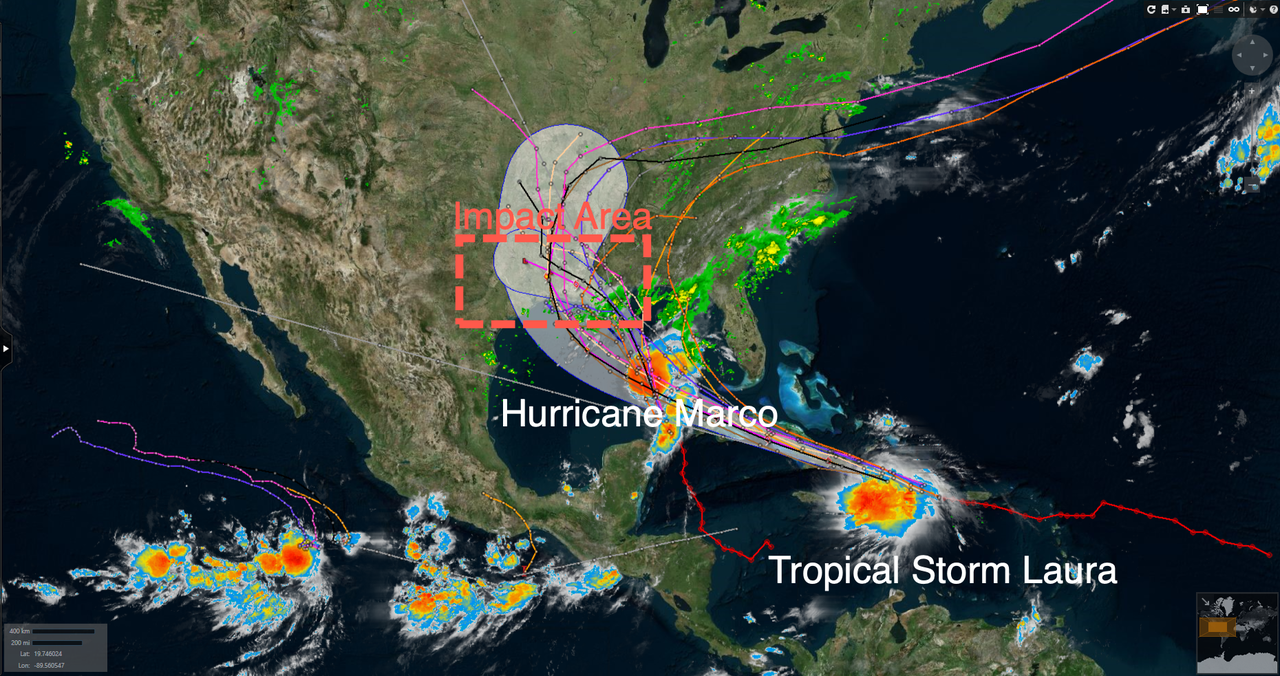
Long-term tracking models for both storms haven’t significantly changed over the last several days. Spaghetti models suggest the storms will make landfall early next week between Texas and Alabama.
As of Sunday afternoon, the National Hurricane Center (NHC) declared Tropical Storm Marco a Category 1 hurricane, with maximum sustained winds of 75 mph. The storm is 300 miles south-southeast of the Mississippi River, with expected landfall Monday afternoon.
“Data from an Air Force Reserve Hurricane Hunter aircraft indicate that Marco has strengthened into a hurricane with maximum winds of 75 mph (120 km/h) with higher gusts,” NHC stated.
Here’s NHC’s full statement of Marco being upgraded to a hurricane:
NHC’s latest radar of Marco barreling towards the Gulf Coast of the US.
#Marco has become a hurricane, according to data from the Air Force @403rdWing Hurricane Hunters. Maximum winds are 75 mph (120 km/h) with higher gusts. https://t.co/MPtF0KuhE3 pic.twitter.com/o7GbutfMHU
— National Hurricane Center (@NHC_Atlantic) August 23, 2020
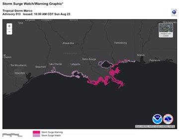
A storm surge warning is in effect from Morgan City, Louisiana, to Ocean Springs, Mississippi.
We coined the term ‘double trouble’ last week with both systems simultaneously swirling in the Gulf, with crosshairs pointed at the Southern US.
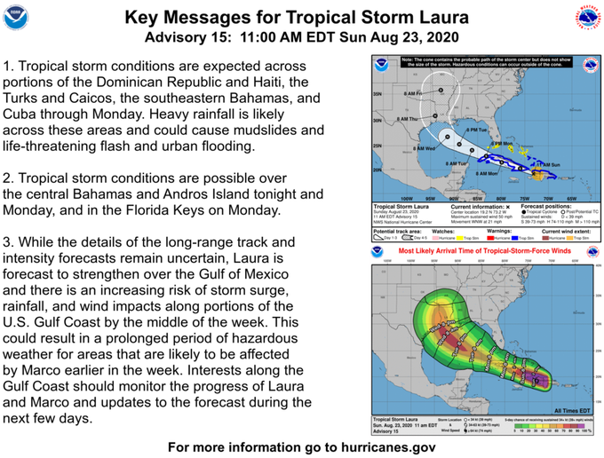
Tropical Storm Laura is causing tropical storm conditions in portions of the Dominican Republic, Haiti, Turks, and Caicos on Sunday. The track and intensity of the storm remain uncertain, but some forecasts indicate it will make landfall in relatively the same area as Marco on Wednesday.
An Air Force Reserve Hurricane Hunter aircraft is en route to investigate Laura Sunday afternoon.
We’re off to fly TS #Laura from Keesler before recovering in Charleston, SC with the rest of our WC-130Js ✈️⛈??#WeatherReady #ReserveReady pic.twitter.com/0Twd1EJNYs
— Hurricane Hunters (@53rdWRS) August 23, 2020
Aaron Carmichael, a meteorologist with the commercial forecaster Maxar, told Bloomberg that two systems positioned in different locations of the Gulf of Mexico to “make landfall within 24 to 36 hours in essentially the same spot” are “really unprecedented.”


