Refinitiv weather analyst Ed Whalen states, in a new report, that big temperature changes are ahead for the central US.
Whalen said parts of the western and central US would see a blast of cold air early next week, for a short period, especially in the Rockies and parts of the Plains. The plunge in temperatures could result in snow for specific areas.
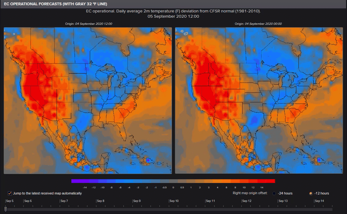
The EC Operational Forecast for the next nine days (Sept. 05-14) daily average two months (F) deviation (with gray freezing line) shows Arctic air will pour into the central and western regions beginning Sept. 08.
Here is Whalen’s Sept. agriculture weather report for Central Plains and Midwest regions:
1-5 Day Forecast: A favorable high rainfall pattern is anticipated through early next week across the Central Plains and Midwest U.S., with the highest totals (nearing 50 mm / ~2 in above normal) in the latter. Despite cooler conditions in the Northern U.S. Plains and Southern Canada, temperatures across the core crop regions of North America will be fairly moderate through the next 5 days. This pattern overall will be largely beneficial for corn and soybeans. It is the 6-10 day period which is more notable.
6-10 Day Forecast: A blast of cold air will drop temperatures to around 5-10 °F below normal across the Central U.S. during this period. Frost/freeze risks for corn and soybean regions are not expected, as only areas west of NE/KS are likely to drop below freezing. On that note, there is a possibility for snow across some of the wheat producing areas of Colorado, which could delay plantings down the line. More on precipitation, a swath of heavy rainfall totals associated with the eastern edge of the low pressure trough will range from the Southern Plains through the Midwest during the 6-10 day period. Overall, this cool and wet weather should be very favorable for late developing corn and soybean crops.
10+ Day Forecast: The latest EC extended run from 03 September depicts continued cold weather persisting through September across the vast majority of the Central U.S., coupled with a near normal precipitation pattern. If persistent, the cold weather could begin to raise concerns further for frost/freeze damage to corn/soybeans as well as delays to wheat plantings. – Whalen
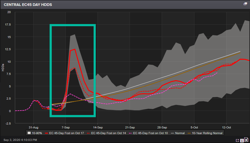
The central US heating degree day (HDD) index will spike on Sept. 7, indicating more energy will be needed to heat a building structure as colder weather rolls in. The spike will be short-lived, but the trend in high and low temperatures will be down as summer appears to be winding down.
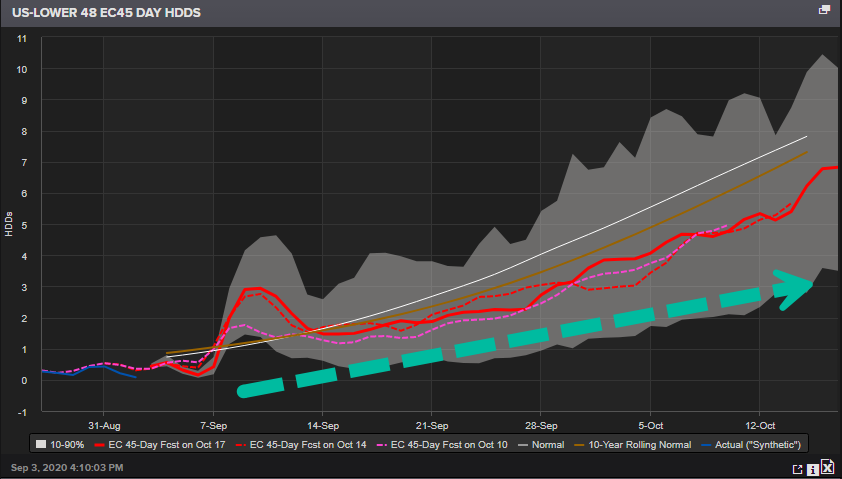
US-lower 48 HDD is set to rise through mid-Oct. as cooler temperatures imply people will have to turn up their thermostats.
As summer transitions to fall, this is particularly bad for restaurants who have been surviving on serving customers on outdoor patios as public health orders limit indoor capacity. It won’t be until Oct./Nov. when temperatures dive further that another wave of eateries will have to shutter operations as patios close.